1947
In early 2022, Historic England put online a large portion of the photographs taken by the RAF in 1947 that covers the entire country. Not all of Kenilworth is covered but here I shall point out a few features of interest.
Historic England Photo Explorer – Enter ‘Kenilworth’ in ‘Find a place’ on the map.
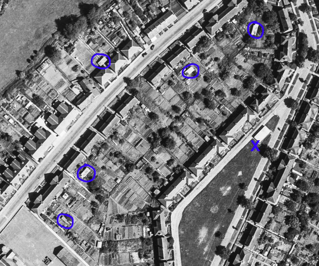
This view of School Lane and Hyde Road shows, circled, a number of air raid shelters. The large one, X, was a public shelter, the others private in back gardens, mostly covering more than one garden. All the houses were council houses at the time; some shelters remain, but sometimes only part.
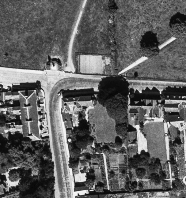
Alongside the War memorial can be seen what was termed an ‘experimental plot’ of 300 sq.yds, it looks about 10 yds by 30 yds. This was set up in May 1941 by the Wartime Horticultural Society to demonstrate to residents how to grow their own food. It was re-seeded in November 1947 to become part of the park once more.
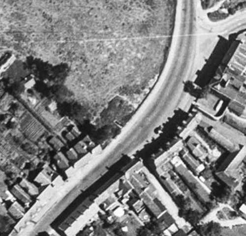
Often overlooked is this surviving air raid shelter in New Street, centre. Its entrance at the middle of one side of a rectangular plot suggests it may be of a different design to those in the Abbey Fields where the entrance is at one end of a long chamber.
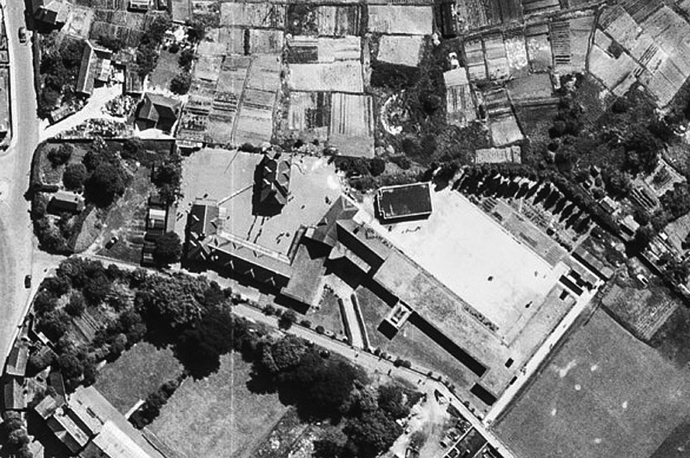
St Nicholas School. Today’s playing field at the top, but then a field owned by the Stickley family, is covered with allotments, part of the wartime ‘Dig for Victory’ campaign. Prominent near the centre is the school’s flat-roofed air raid shelter and to its right, following the line of trees and beyond the end of the buildings, are the school’s own allotments in which the pupils grew vegetables for school meals, which the girls helped cook. (More of this, and wartime school life in general can be found in World War 2 Comes to Kenilworth which also includes several wartime photographs of the school and its pupils). Bottom right can be seen the playing field with what appears to be wear marks from rounders matches.