What might have been…….
As lockdown appears to be coming to a gradual end, then so too will these lockdown articles, but I thought it would be an idea to write about history that never happened; plans for Kenilworth that didn’t come to fruition. This article is very reliant on the plans and diagrams.
The destruction of much of Abbey End in 1940 led to a lot of scheming, even whilst the war was still being fought.
In 1943 the Council started discussions about the post-war rebuild and in April 1944 a photograph of a model of the proposals appeared in the Leamington Courier (which is included in World War 2 Comes to Kenilworth )
The bomb-damaged buildings were demolished in June 1945, and compulsory purchase of the land took place the following month. However, there were government restrictions on building work and Kenilworth’s was not seen as a necessity in the grand scheme of things.
And so, for the next 20 or so years, schemes were developed, and came and went, before the town centre we have today was finally built; the timely closure of the tannery helped.
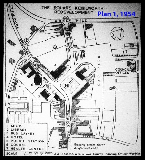
The first plan I have, Plan 1, is from 1954. The key to it is self-explanatory, but it is worth pointing out the re-routed Abbey End making a T-junction; a designed bottleneck if ever there was one. The clock tower was to be moved as well, and note the Courts, these appeared on many variations of the plans, but were eventually omitted.
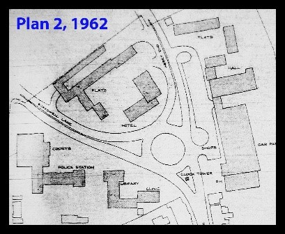
Plan 2; a 1962 scheme introduced the idea of a roundabout, and also included providing a public assembly hall, something which even then had been discussed for close on 80 years, and for which we are still waiting!
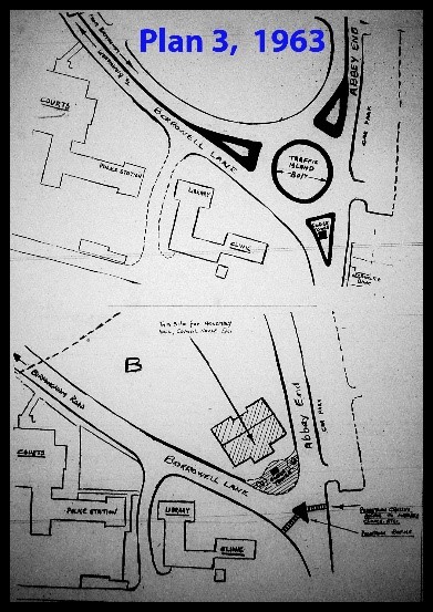
Then in 1963, Plan 3, two schemes were published side-by-side; one was based upon that of the previous year but the other retained the existing road layout but moved the clocktower to the front of new municipal buildings.
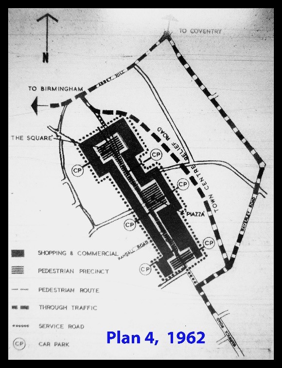
Running alongside this in 1962 was Plan 4, an idea to create a traffic-free town centre, utilising the space created by the bombsite and closure of the tannery. Key to it was creating a town-centre relief road via a continuation of the then cul-de-sac Bertie Road, to connect with Abbey End through the bombed area. It was this scheme that evolved into the Talisman Square and Abbey End developments – pedestrian areas without removing the traffic!
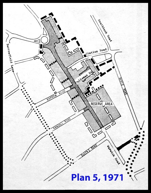
Pedestrianisation of the town centre returned in 1971, Plan 5, and included a new short road to feed Bertie Road, and the creation of a new road along the course of the jitties between Queens Road and Barrowfield Lane; it would have involved the demolition of the houses alongside; the KWN politely stated, ‘the residents involved are expressing their opinions in a petition’. The traffic for Birmingham and Coventry would have gone their separate ways near Clarendon Road rather than the clocktower.
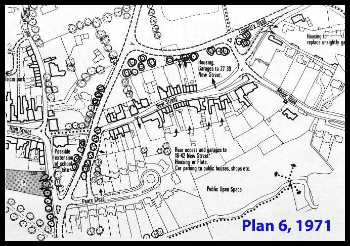
Finally to New Street, Plan 6. This was 1970, running alongside the pedestrianisation plan, creating a new road from Bridge Street and a re-alignment of Coventry Road. A new short road from Pears Close fed New Street to improve the access to the New Street shops; I suppose it could be argued that the non-implementation of this scheme is what caused the closure of all the New Street shops. There was also to be a new car park at the rear of High Street.
All these schemes were of course under the Kenilworth Urban District Council, and I think most will agree that some of these plans would have been a disaster, but it also highlights the difficulty of planning any road system for Kenilworth’s town centre. A non-traffic town centre is still regularly debated but the problem is always, where will the traffic go? At least until the 1960s there were spaces that provided possibilities, but today there are none.
All plans are taken from the Kenilworth Weekly News.