The Railway by Maps
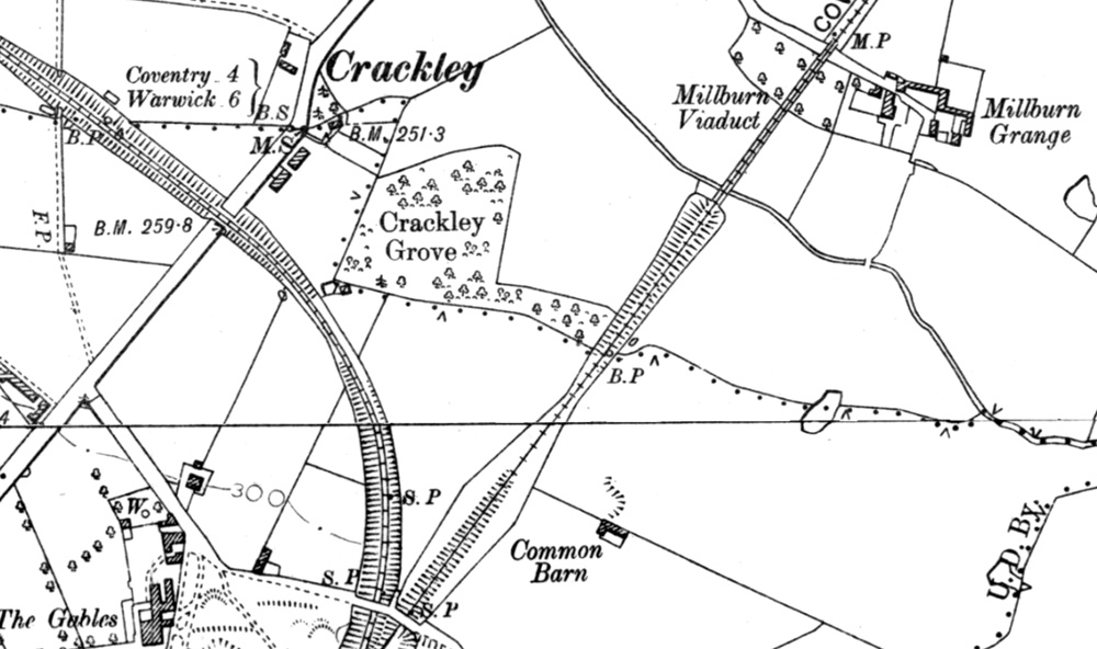 |
The railway entered the town from the north at Milburn Grange. A seventeen arch viaduct (later reduced to three arches) carried the line over the brook and into a deep cutting through sandstone.
The line to Berkswell was added later. |
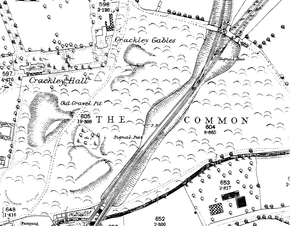 |
The Common played a large part in the construction of the railway. It was likely the site of a shanty town for the navvies, but certainly provided sand and gravel for construction and large excavations can still be seen; these continued to be used after the railway was completed.
It was also the site of the later junction for the line to Berkswell (1884) and the siding down to Mill End (1869). |
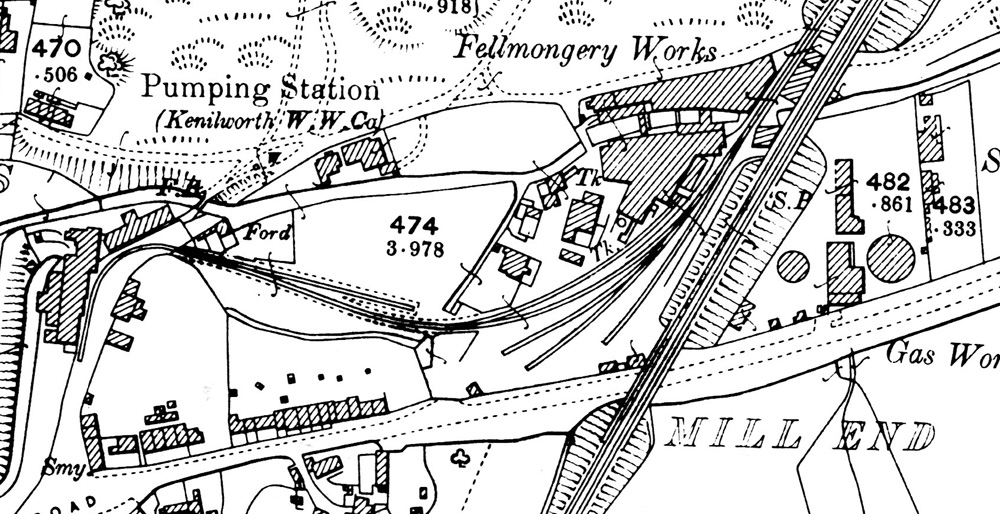 |
Fed by the siding installed by Henry Street in 1869, Mill End became Kenilworth’s first industrial estate. Street owned the fellmongery, centre, but the siding continued to the mill where Forge Road is now. Near the road the sidings were used by coal merchants, and coal was also taken to the gas works on the opposite side of the railway.
There was also a saw mill and the Kenilworth Water Company pumping station in the same area. |
 |
After crossing Mill End on an arched bridge, the railway enters a cutting to pass under Park Hill, which had been a narrow track on a steep slope until the bridge was built to carry it over the railway. |
  |
| These two maps show how the area north of the station was influenced by the arrival of the railway.
The Whitemoor brickworks, that nearest the station, had started before the railway came but grew in the 1870s when a siding was installed so that produce could be despatched far and wide. New kilns were built to increase the output. The Cherry Orchard works was established in the late 1880s, not surprisingly on the site of an orchard, and from the beginning had a siding which also of course facilitated incoming coal for the kilns. Also, note the glasshouses of Kenilworth’s growing market gardens, again they used the railway extensively to ship produce all over the country. Originally, a level crossing was planned for Spring Lane / Whitemoor Road, but locals protested and the railway company had to incur extra costs and install a bridge. |
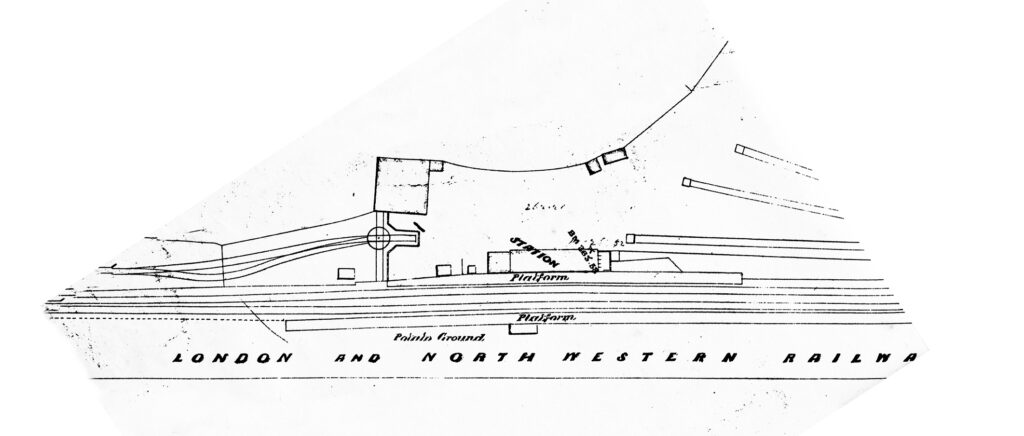 |
Kenilworth station in about 1877 when the original building was still in use. It was not double track, but a passing loop was in place to accommodate two trains.
The wagon turntable fed the goods shed and a platform for the loading of horse-drawn carriages onto wagons so the well-off could take their personal transport with them! The all-important coal yard is to the right, the Coventry end. |
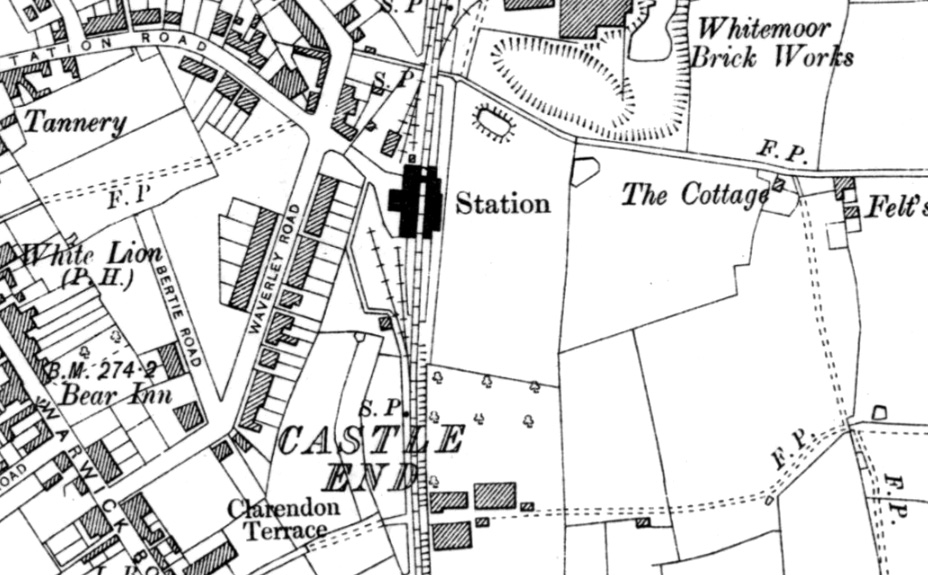 |
Post 1884, the rebuilt station had coal (southern yard) and freight (northern yard) handling facilities. Station Road was built across open fields to connect the railway to the town.
At the northern end of the station a level foot crossing was replaced by a footbridge in 1884. South of the station was another foot crossing at the end of what is now Clarendon Road; this remained until the mid 1960s when the current footbridge with slopes was built. The goods yard at the northern end is the site of the third station. |
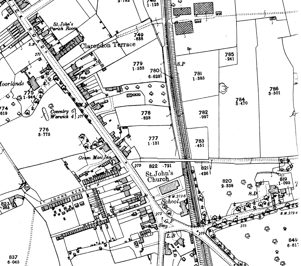 |
Continuing south of the Clarendon Road crossing, the railway went under what is now a footbridge to Farmer Ward Road but was originally Dodson’s Lane, a lane across otherwise open fields across to Windy Arbour.
The bridge at St Johns carried a road junction; the church was not built until the decade after the railway. |
 |
When the line was built, it sliced in half another brickworks, in the first field south of the bridge. Perhaps if the operator of the works had been a little more enterprising and installed a siding from the railway the brickworks may have flourished; instead, it closed.
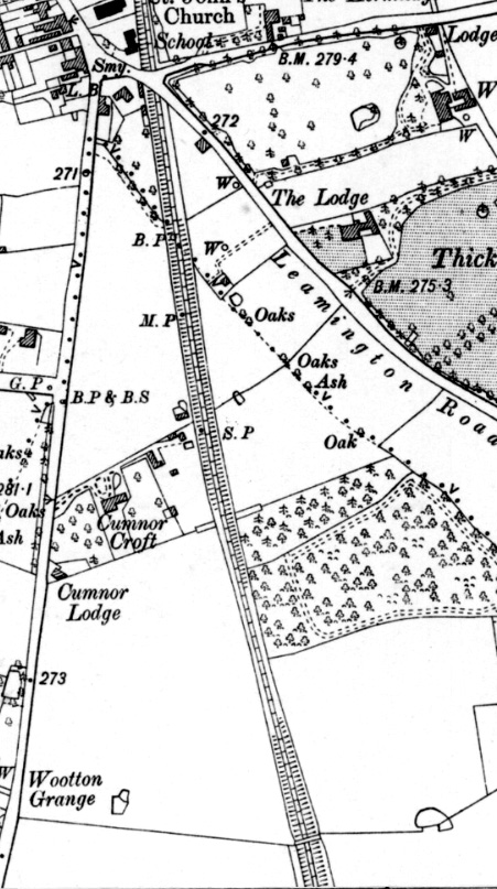
Just alongside Cumnor Croft can be seen the slopes of an abandoned footbridge; there was still evidence of this as recently as 20 years ago, but may have now all gone. Just near to Wootton Grange is another bridge; this is that with the Leigh family coat of Arms and the date of construction, 1844, carved onto it. |
More Railway articles on this website:
Kenilworth’s Railway, a brief history of its early years Kenilworth’s First railway station
Kenilworth’s Second Station Kenilworth Second Station Demolished Kenilworth’s Third Station
Railway structures from the 1840s and 1880s Railway Protestations – 1840 & 2010
Iconic Station Photograph Investigated The end for Historic Bridges? Demolition of historic building